Difficulty
Difficult
Duration
7 Days
Max.Altitude
16,240 ft.
Suitable
18 - 55 Years
Distance
50 kms
Basecamp
Sankri
Pickup/ Drop
Dehradun
Offloading
Available
Region
Uttarakhand
Know Everything About Bali Pass Trek
The Bali Pass Trek is a high-altitude, offbeat expedition in the Garhwal region of Uttarakhand, designed for experienced trekkers looking for raw Himalayan adventure. The trek spans from the picturesque Har Ki Dun Valley and culminates at Yamunotri, one of the Char Dham pilgrimage sites, crossing the majestic Bali Pass at an altitude of 4,950 meters (16,240 feet).
The trail offers a striking contrast in landscapes—starting with verdant forests of oak, deodar, and pine, moving through traditional mountain villages like Osla and Seema, and ascending into alpine meadows (bugyals), glacier moraines, and snow-covered high passes. The region is rich in biodiversity, and sightings of Himalayan wildlife and exotic flora are common.
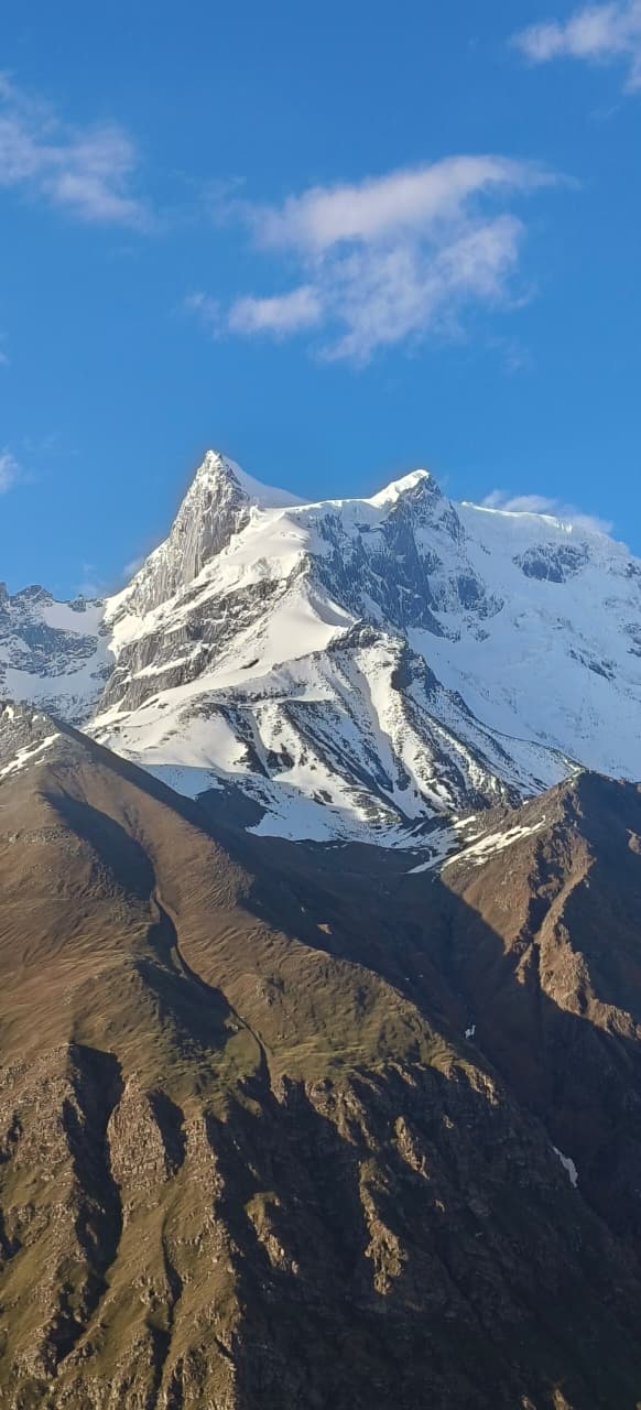
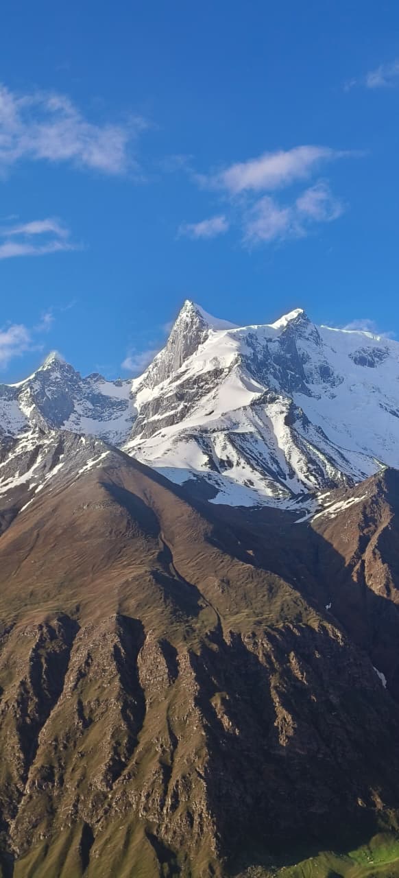
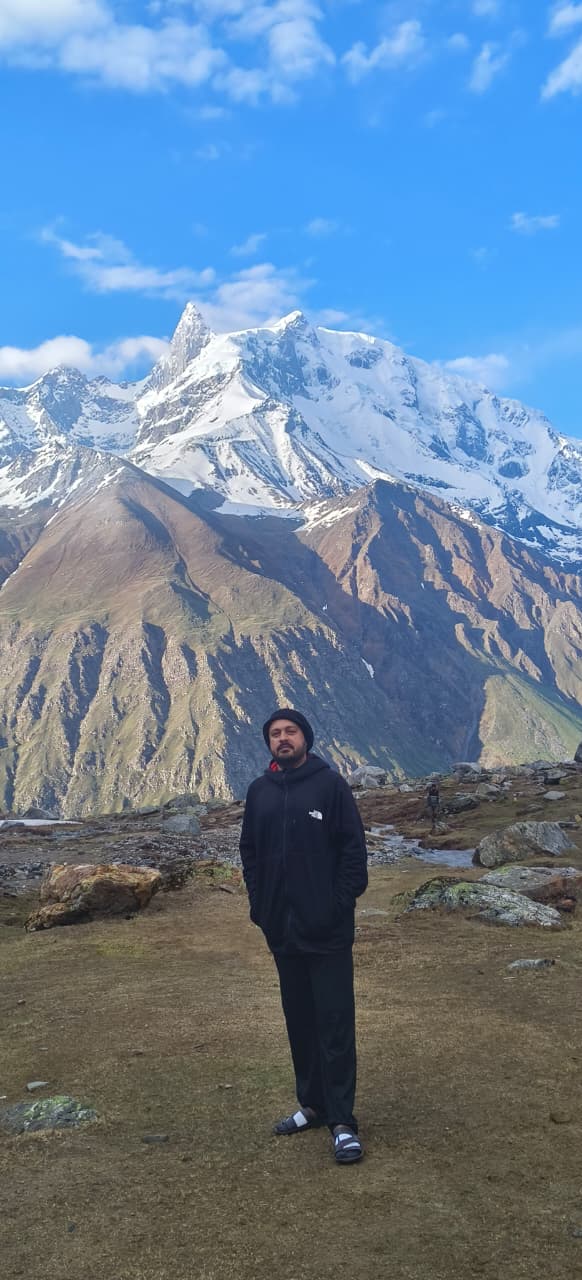
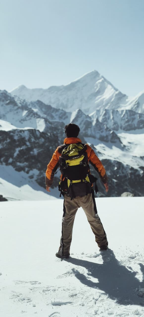
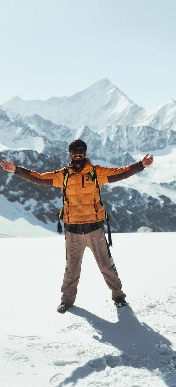
Trekkers are treated to panoramic views of snow-capped peaks such as Swargarohini I, II & III, Kala Nag (Black Peak), and Bandarpoonch, making it a visual feast for nature lovers and photographers. The cultural immersion in remote villages—where the architecture, language, and lifestyle remain rooted in ancient Garhwali traditions—adds a unique human element to the trek.
The final push to the summit of Bali Pass involves steep ascents over snow and scree, often requiring the use of technical equipment depending on the season. The descent towards Yamunotri is equally dramatic, bringing trekkers down from icy ridges into sacred valleys steeped in mythological significance.
Due to its demanding terrain, high altitude, and remote location, the Bali Pass Trek is best suited for experienced trekkers with good physical fitness and prior high-altitude trekking experience. It is typically undertaken between May–June and September–October, avoiding the monsoon and peak winter snow.
Bali Pass Trek Itinerary
Day 1. Dehradun To Sankri
Distance: ~200 km (by road)
Duration: 8–10 hours (drive)
Altitude: Dehradun (430 m) → Sankri (1,950 m)
The Bali Pass Trek begins with a long but incredibly scenic drive from Dehradun to Sankri, a quaint Himalayan village nestled deep in the Govind Pashu Vihar National Park. The journey covers around 200 kilometers and typically takes 8 to 10 hours by road. As you leave behind the hustle of Dehradun, the landscape quickly transforms. The road climbs gradually through the lower Himalayan foothills, passing lush pine forests and small hill towns.
The drive takes you through Mussoorie bypass, then winds through the serene hill towns of Purola, Mori, and Netwar—offering stunning views of the Tons River cutting through steep gorges and terraced valleys. Keep your camera handy, as the road is dotted with beautiful pine-covered hills, apple orchards, and misty ridgelines. From Purola onwards, the mobile network becomes patchy, with BSNL being the most reliable option. Make sure to withdraw cash in Purola, as there are no ATMs beyond this point.
By late afternoon or early evening, you’ll arrive at Sankri, a peaceful village located at an altitude of 1,950 meters, surrounded by dense forests and framed by towering snow-clad peaks. Sankri serves as the base camp for many treks in Uttarakhand, including Har Ki Dun, Kedarkantha, and Bali Pass. The village has basic infrastructure, with a few homestays, small shops, and warm hospitality provided by the local Garhwali community.
Upon arrival, trekkers typically check into a guesthouse or homestay, followed by a short briefing by the trek leader about the itinerary, safety instructions, and gear checks. If the skies are clear, you may even catch a glimpse of the majestic Swargarohini Peak from certain spots in the village—a perfect introduction to the Himalayan grandeur that lies ahead.
Day 1 is all about soaking in the mountain atmosphere, adjusting to the altitude, and preparing both mentally and physically for the challenging trek to come. It’s important to rest well, stay hydrated, and allow your body to begin acclimatizing to the higher elevation.
Day 2. Sankri To Devsu Bugyal
Distance: ~7 kilometers (one way)
Time Required: 4 to 6 hours
Starting Altitude (Sankri): ~1,950 meters (6,398 feet)
Ending Altitude (Devsu Bugyal): ~3,000 meters (9,850 feet)
Altitude Gain: ~1,050 meters
The journey from Sankri to Devsu Bugyal is the perfect introduction to the raw beauty of the Uttarakhand Himalayas. Nestled in the Govind Pashu Vihar National Park, this short yet enchanting trek offers a blend of dense forests, river crossings, and open meadows with jaw-dropping views of snow-capped peaks. The trail begins in the quaint village of Sankri—a popular base for multiple treks in the region including Har Ki Dun, Kedarkantha, and Bali Pass—and winds through towering pine forests and streams to reach the pristine alpine meadow of Devsu Bugyal.
At approximately 7 km in distance, the Sankri to Devsu trail can typically be covered in 4–6 hours, making it ideal for acclimatization or a relaxed first-day hike on longer expeditions. The route starts with a descent to the Tons River, where trekkers cross a sturdy bridge before beginning a steady climb through a thick forest of oak, rhododendron, and walnut trees. The climb is moderate but continuous, with occasional openings in the foliage offering breathtaking views of the valley below and the surrounding peaks.
As you ascend higher, the dense canopy gives way to a lush meadow—Devsu Bugyal—spread across a wide plateau at an altitude of around 3,000 meters (approx. 9,850 feet). This alpine pasture is known for its velvety green grass, colorful wildflowers (especially during the monsoon months), and panoramic views of towering Himalayan ranges including Kala Nag (Black Peak) and Swargarohini. The meadow is a haven for bird watchers and photographers alike, offering golden hours that bathe the landscape in magical light.
Camping at Devsu Bugyal is a serene experience. Away from any settlements, the silence of nature is broken only by the rustle of leaves and the call of Himalayan birds. Trekkers often spend the night here before continuing onward to Ruinsara Tal, Bali Pass, or Har Ki Dun, but the meadow itself is worthy of being a standalone destination for a short, offbeat Himalayan adventure.
Day 3. Devsu Bugyal To Ruinsara
Distance: ~12 kilometers
Time Required: 6 to 7 hours
Starting Altitude (Devsu Bugyal): ~3,000 meters (9,850 feet)
Ending Altitude (Ruinsara Tal): ~3,500 meters (11,483 feet)
Altitude Gain: ~500 meters
Trail Type: Gradual ascent along the river, mixed terrain (forest, rocky patches, open valley)
The trail from Devsu Bugyal to Ruinsara Tal is one of the most scenic sections of the entire route. The day begins with an early morning departure from the meadow, where trekkers follow a well-defined trail that descends slightly before rejoining the main path running parallel to the Ruinsara Gad (river). This river will remain your companion for most of the day.
The route gradually ascends through dense forest patches, opening occasionally into vast clearings that offer unobstructed views of surrounding Himalayan peaks like Swargarohini I-IV, Kala Nag, and Bandarpunch. Trekkers cross several small streams and negotiate rocky outcrops and landslide-prone sections, especially after the monsoon season.
As you continue, the valley widens, and the tree line begins to thin out. The landscape becomes more rugged and alpine, dotted with boulders and scattered shrubs. After crossing a few wooden bridges and possibly small glacier-fed streams, the trail culminates at the serene and picturesque Ruinsara Tal—a high-altitude lake nestled amidst towering peaks and alpine meadows.
Camping near Ruinsara Tal, at approximately 3,500 meters, is an unforgettable experience. The lake is considered sacred by locals and is surrounded by towering mountains and peaceful wilderness. It’s a perfect place to acclimatize before pushing further toward Bali Pass or to simply soak in the untouched beauty of the region.
Day 4. Ruinsara To Odari
Distance: ~4 kilometers
Time Required: 3 to 4 hours
Starting Altitude (Ruinsara Tal): ~3,500 meters (11,483 feet)
Ending Altitude (Odari Camp): ~4,100 meters (13,450 feet)
Altitude Gain: ~600 meters
Trail Type: Gradual to steep ascent; alpine terrain with moraine, scree, and rocky patches
Difficulty Level: Moderate (short distance but high-altitude gain)
The trek from Ruinsara Tal to Odari marks the beginning of the transition into a more rugged, high-altitude alpine environment. The trail leaves behind the meadows and lake views of Ruinsara and heads toward the glacier-carved valley leading to Bali Pass. Though the distance is relatively short at about 4 kilometers, the significant altitude gain of 600 meters makes it a crucial day for acclimatization.
The route starts with a gentle climb through sparse vegetation and rocky trails, often hugging the sides of the valley. As you gain altitude, the terrain shifts to more moraine and scree, with loose rocks and occasional narrow paths that demand careful footing. Snow patches may be present, especially in the early summer season (May–June) or after fresh snowfall in late autumn.
Odari, which means “cave” in the local dialect, gets its name from a natural rock cave located nearby, believed to have been used by Bali—the mythological figure associated with this region—for meditation. The Odari campsite, perched at around 4,100 meters, is set in a dramatic alpine landscape surrounded by massive snow-clad peaks and sharp ridgelines. It serves as the base for the final push to Bali Pass, making it an essential stop for acclimatization and rest.
Due to the altitude and exposure, temperatures at Odari can drop significantly, especially after sunset. Trekkers are advised to stay warm, hydrate well, and rest properly in preparation for the challenging ascent to Bali Pass the next day.
Day 5. Odari To Bali Pass Basecamp
Distance: ~3 kilometers
Time Required: 2 to 3 hours
Starting Altitude (Odari Camp): ~4,100 meters (13,450 feet)
Ending Altitude (Bali Pass Base Camp): ~4,600 meters (15,091 feet)
Altitude Gain: ~500 meters
Trail Type: Steep ascent over rocky terrain, scree, and patches of snow
Difficulty Level: Moderate to Difficult (short but steep, at high altitude)
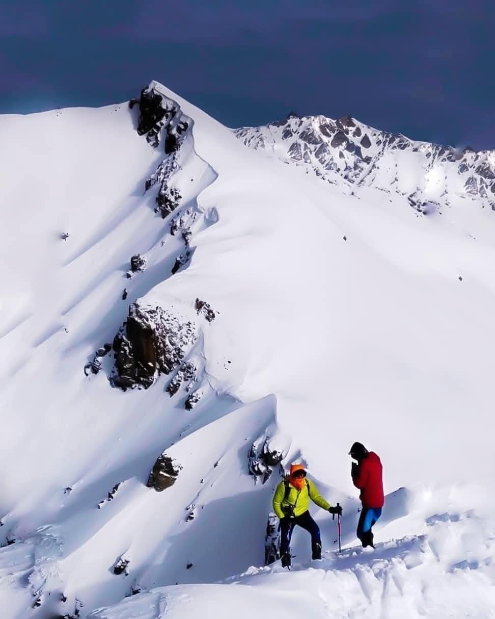
The trek from Odari to Bali Pass Base Camp is short in distance but challenging due to the steep gradient, thin air at high altitude, and exposed alpine terrain. This section is crucial for acclimatization and prepares you for the demanding summit day to Bali Pass (4,950 meters). The base camp is the final campsite before the summit attempt.
The trail starts from Odari (4,100 m) with a steep and steady climb, navigating through sections of loose moraine, scree slopes, and possible snow patches, especially in early summer or late autumn. The landscape is rugged and completely barren — no trees or vegetation, only sharp ridgelines, glacial debris, and snow-dusted peaks surrounding you on all sides.
As you ascend, the air gets noticeably thinner, and the pace slows. Frequent hydration, slow movement, and controlled breathing are essential here to avoid altitude sickness. Along the way, you’ll get increasingly dramatic views of towering Himalayan giants like Swargarohini, Kala Nag, and Bandarpunch, with the Bali Pass itself looming ahead like a snow-capped gateway.
Upon reaching Bali Pass Base Camp (~4,600 m), you’ll find a flat camping area nestled in a natural bowl between ridges. The wind can be strong and temperatures dip well below freezing at night, so proper layering and gear are a must. From here, trekkers get their first full view of the Bali Pass ridgeline and the sharp ascent that awaits on the next day.
This day is typically kept short to allow the body to adjust to high altitude and to conserve energy for the long and strenuous summit day ahead. Early dinner and a pre-dawn start are recommended the following morning for the crossing of Bali Pass and descent to Lower Dhamni.
Day 6. Basecamp To Bali Pass Summit Descent To Lower Damini
Distance: ~12 kilometers total (5 km ascent + 7 km descent)
Time Required: 8 to 10 hours
Starting Altitude (Base Camp): ~4,600 meters (15,091 feet)
Summit Altitude (Bali Pass): ~4,950 meters (16,240 feet)
Ending Altitude (Lower Dhamni): ~2,600 meters (8,530 feet)
Altitude Gain: ~350 meters (to summit)
Altitude Loss: ~2,350 meters (descent to Lower Dhamni)
Trail Type: Steep, rocky, and scree slopes for ascent; steep descent through forest and villages
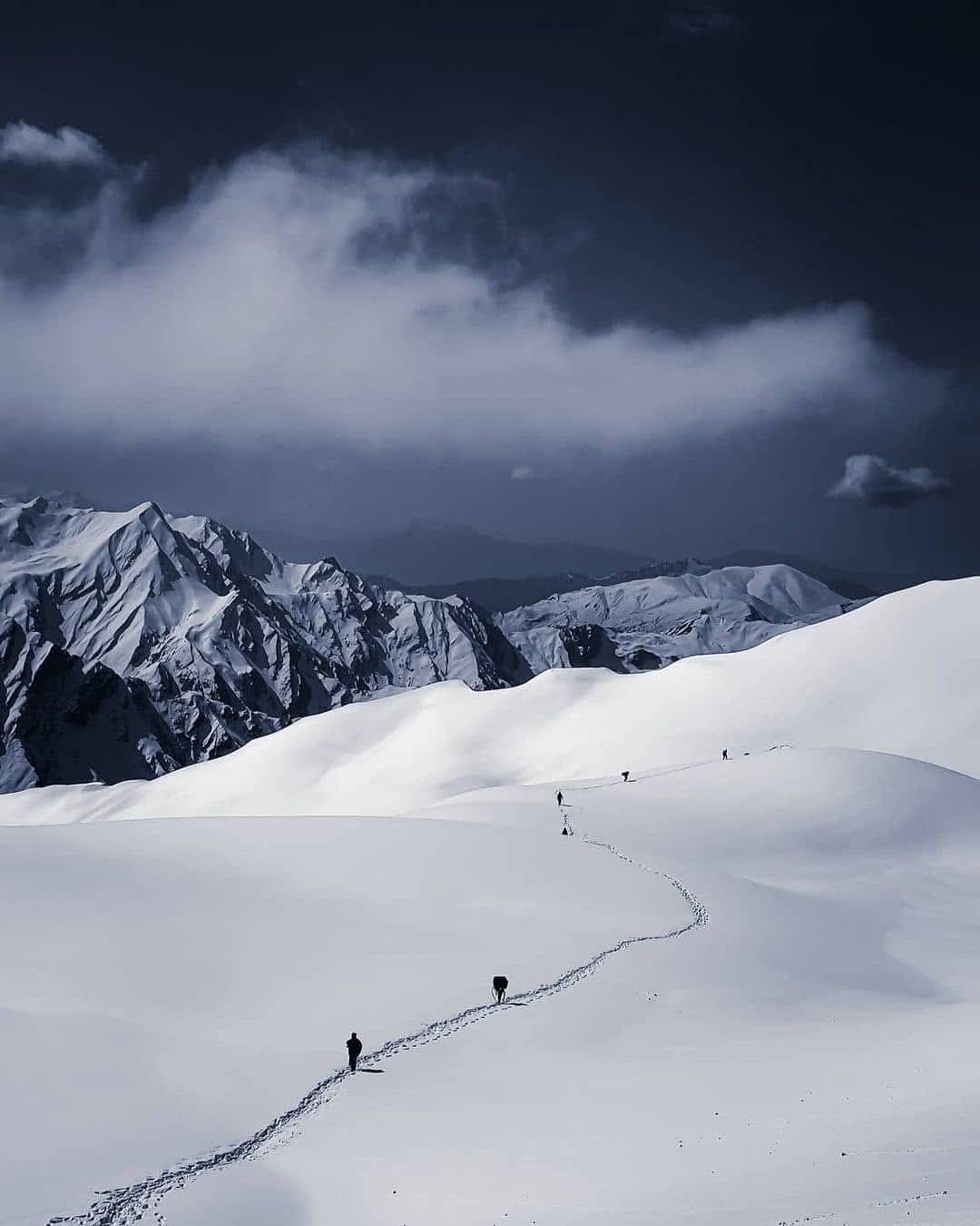
The final day of the Bali Pass trek is the most demanding but rewarding. Starting early (usually before sunrise) from Bali Pass Base Camp (4,600 m), trekkers begin the steep and rocky climb toward the Bali Pass summit at 4,950 meters. The ascent covers about 5 kilometers, with a steady gradient that includes some challenging scree patches, snowfields (season dependent), and narrow ridgelines.
The summit offers breathtaking panoramic views of the surrounding Himalayan peaks, including the mighty Swargarohini range, Bandarpunch, and the vast Govind Wildlife Sanctuary. The cold winds and thin air make this the toughest section, so trekking poles, layered clothing, and acclimatization are crucial.
After savoring the summit views, the descent begins — a longer but faster journey that covers around 7 kilometers downhill to Lower Dhamni village at approximately 2,600 meters. The trail drops steeply through alpine meadows before entering thick forests of oak and pine. Trekkers will cross small streams and local footpaths used by shepherds and villagers.
The descent can be tough on knees due to the sharp altitude loss, so trekking poles and careful pacing are recommended. Lower Dhamni is a quaint village where you can find rest and local hospitality after the challenging trek.
Day 7. Lower Damini To Janki Chatti To Dehradun
- Distance: ~163 kilometers total (11–12 km trek + ~151 km drive)
- Time Required: 8 to 10 hours (2 days recommended)
- Starting Altitude (Lower Damini): ~2,600 meters (8,530 feet)
- Midpoint Altitude (Janki Chhati): ~2,650 meters (8,694 feet)
- Ending Altitude (Dehradun): ~640 meters (2,100 feet)
- Altitude Gain: ~50 meters (to Janki Chhati)
- Altitude Loss: ~2,010 meters (to Dehradun)
- Trail Type: Stone-paved pilgrim trail and forested descent (trek); mountain roads for drive
The descent from Lower Damini begins with a forested trail that gradually leads to Yamunotri Temple, a sacred site in the Char Dham Yatra. The trek segment is approximately 6–7 km and includes stone steps, pine forests, and occasional river crossings. It takes around 3–4 hours depending on pace and weather. You may stop briefly at Yamunotri to explore the temple or hot springs.
From Yamunotri to Janki Chhati, the trail is another 5–6 km down a well-maintained pilgrim path, often used by ponies and pilgrims. This segment takes 2–2.5 hours, with scenic views of the Yamuna valley and forested surroundings. Janki Chhati serves as a comfortable rest stop with lodges and small eateries. It is the last road-accessible point before Yamunotri and ideal for an overnight stay.
The next day, the road journey begins from Janki Chhati to Dehradun, first descending to Barkot (~45 km, 2–2.5 hours) through narrow mountain roads and terraced hill farms. From Barkot, you continue your drive to Dehradun (~120 km, 4–5 hours) along scenic valleys and river gorges, passing towns like Naugaon and Damta. This part of the journey transitions from high mountains to the Doon Valley. Road conditions vary, but a private taxi or shared jeep is commonly used.
The full journey offers a blend of nature, spirituality, and traditional Garhwali mountain life—concluding your Himalayan trek in the capital city of Uttarakhand.
Bali Pass Trek Cost Terms
What's Included
1. Transportation
Shared transportation from Dehradun to Sankri and return
Vehicles used: Tempo Traveller, Bolero, or Sumo
Pickup and drop typically from ISBT Dehradun or Railway Station
2. Accommodation
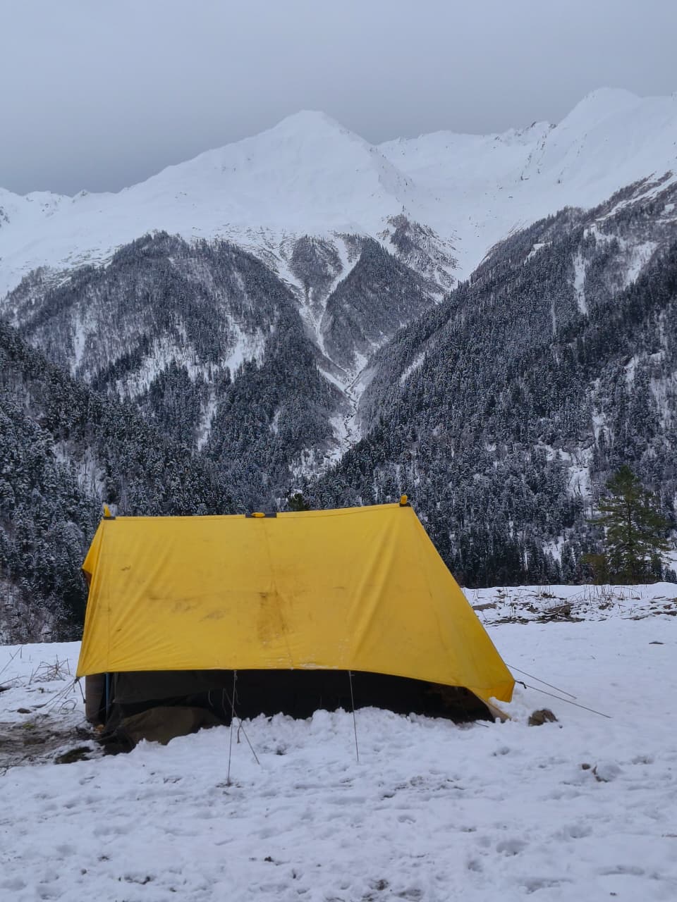
2 night stay in homestay in Gangad (on arrival)
4 nights camping during the trek in alpine tents
Triple sharing tents with sleeping bags, foam mats, and liners
Clean toilet tents and separate kitchen/dining tents
3. Meals
All vegetarian meals included from Day 1 dinner to Day 7 breakfast
Morning tea/coffee, hot lunch/dinner, and light evening snacks
Egg options may be available in some packages
Hygienic and nutritious Indian meals prepared by trek cooks
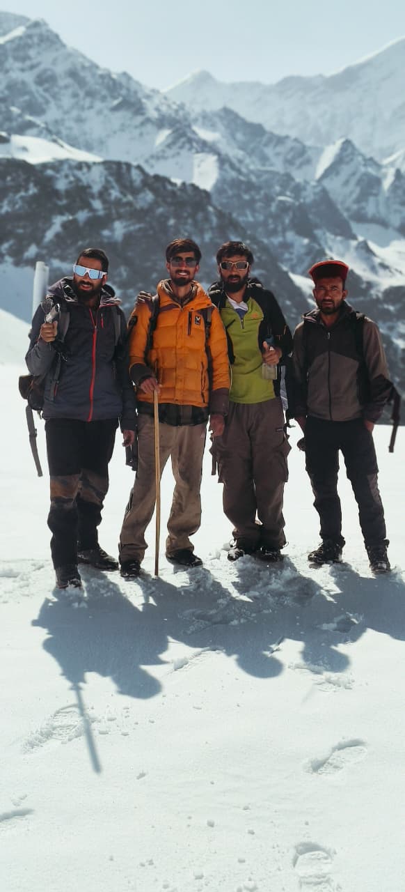
4. Trekking Staff
Certified trek leader and trained mountain guide
Cook, helper, and support staff
Porters or mules for carrying common equipment and supplies
5. Trekking Equipment
Waterproof alpine tents, dining tents, toilet tents
Sub-zero rated sleeping bags, liners, and foam mattresses
Microspikes and gaiters for snow-covered trails (seasonal)
Group gear and utensils for cooking and serving meals
Additional Inclusions
Trekking permits and forest entry fees
Entry to Govind Wildlife Sanctuary
Basic first-aid kit, oximeter for oxygen level checks
Oxygen cylinder for emergencies (in select packages)
What's Excluded
5% GST on the total package cost
Travel to and from Dehradun (flights, trains, buses)
Meals during transit (while traveling to/from Sankri or Dehradun)
Personal trekking gear (shoes, jackets, backpack, walking stick, etc.)
Backpack offloading charges (if you don’t want to carry your own bag)
Travel or medical insurance
Emergency evacuation charges (in case of illness, injury, or bad weather)
Extra snacks, cold drinks, and bottled water
Tips for guides, porters, and staff (optional)
Personal expenses (laundry, phone recharge, medicines, etc.)
Higher forest/permit fees for foreign nationals
Anything not mentioned under “inclusions”
Bali Pass Trek Packages Costs
Sankri To Janki Chatti
₹ 18,500/- PP
₹ 14,999/-PP
- 6 Nights Accomodation
- Breakfast, Lunch, Dinner & Sbacks
- Forest Permit & Fees
- Trek Guide
- Trekking Central Equipments
- Safty & First Aid
Dehradun To Dehradun
₹ 23,500/- PP
₹ 20,999/-PP
- Dehradun To Dehradun Transport
- 6 Nights Accomodation
- Breakfast, Lunch, Dinner & Sbacks
- Forest Permit & Fees
- Trek Guide
- Trekking Central Equipments
- Safty & First Aid
Delhi To Delhi
₹26,500/- PP
₹ 23,999/-PP
- Delhi To Delhi
- 6 Nights Accomodation
- Breakfast, Lunch, Dinner & Sbacks
- Forest Permit & Fees
- Trek Guide
- Trekking Central Equipments
- Safty & First Aid
Bali Pass Trek Terms And Conditions
Advance Booking & Payment
Advance Payment: 20% of the trek cost is to be paid at the time of booking to confirm your slot.
Remaining Payment: The balance 80% of the trek cost must be paid at the time of pickup/start of the trek.
Refund & Cancellation Policy
45 days or more before the trek start date: 90% of the trek cost will be refunded.
30 to 44 days before the trek start date: 50% of the trek cost will be refunded.
21 to 29 days before the trek start date: 25% of the trek cost will be refunded.
15 to 20 days before the trek start date: No refund will be provided.
Less than 15 days before the trek start date: No refund will be provided.
Bali Pass Trek Departures Dates
September 2025
19 Sep – 24 Sep
20 Sep – 25 Sep
25 Sep – 30 Sep
26 Sep – 01 Oct
27 Sep – 02 Oct
Available
Available
Available
Available
Available
Available
Book Now
Book Now
Book Now
Book Now
Book Now
Book Now
October 2025
02 Oct – 07 Oct
03 Oct – 08 Oct
04 Oct – 09 Oct
09 Oct – 14 Oct
10 Oct – 15 Oct
11 Oct – 16 Oct
16 Oct – 21 Oct
17 Oct – 22 Oct
18 Oct – 23 Oct
23 Oct – 28 Oct
24 Oct – 29 Oct
25 Oct – 30 Oct
31 Oct – 05 Nov
Available
Available
Available
Available
Available
Available
Available
Available
Available
Available
Available
Available
Available
Book Now
Book Now
Book Now
Book Now
Book Now
Book Now
Book Now
Book Now
Book Now
Book Now
Book Now
Book Now
Book Now
November 2025
01 Nov – 07 Nov
02 Nov – 08 Nov
03 Nov – 09 Nov
13 Nov – 19 Nov
14 Nov – 20 Nov
15 Nov – 21 Nov
20 Nov – 26 Nov
21 Nov – 27 Nov
22 Nov – 28 Nov
27 Nov – 03 Dec
28 Nov – 04 Dec
29 Nov – 05 Dec
Available
Available
Available
Available
Available
Available
Available
Available
Available
Available
Available
Available
Book Now
Book Now
Book Now
Book Now
Book Now
Book Now
Book Now
Book Now
Book Now
Book Now
Book Now
Book Now
How To Reach Bali Pass Trek
Pickup Place
Prince Chowk, Dehradun
Pickup Time
06:30 AM - 07:30 AM
Drop Place
Prince Chowk, Dehradun
Drop Time
07:30 PM - 08:30 PM
Dehradun is well-connected to major cities of India by air, train, and road.
By Air:
- The nearest airport is Jolly Grant Airport, Dehradun (DED), located 25 km from the city center.
- Direct flights operate from Delhi, Mumbai, Bengaluru, and other metro cities.
By Train:
- Dehradun Railway Station connects to cities like Delhi, Kolkata, Lucknow, and Varanasi.
- Popular trains include Dehradun Express, Nanda Devi Express, and Shatabdi Express (from Delhi).
By Road:
- Dehradun is accessible by buses and taxis from Delhi (250 km / 6–7 hours).
- Regular Volvo and state transport buses run from ISBT Kashmiri Gate, Delhi to Dehradun.
Bali Pass Trek Fitness
Bali Pass Trek – Fitness Requirements
1. Physical Fitness
High level of physical fitness is mandatory due to steep ascents, high altitude, and long trekking days
Trekkers should be able to jog or brisk walk 5 km in 30–35 minutes
Ability to climb 10–12 floors without exhaustion is recommended
Must have experience with at least one moderate to difficult Himalayan trek
2. Cardiovascular Endurance
Strong stamina is essential due to long walking hours (6–10 hours daily)
Regular aerobic exercises like running, cycling, swimming, or stair climbing advised for at least 4–6 weeks prior
Interval training and hiking on inclined terrain are especially beneficial
3. Strength & Flexibility
Core and leg strength are crucial for uphill climbs and descending steep trails
Recommended strength workouts: squats, lunges, planks, push-ups
Daily stretching and yoga improve flexibility and reduce injury risk
4. Acclimatization Readiness
Trek reaches a max altitude of 4,950 m, so ability to adapt to low oxygen levels is vital
Prior high-altitude experience is helpful
Hydration, proper layering, and rest are essential during the trek to prevent AMS (Acute Mountain Sickness)
5. Mental Preparedness
Trek involves remote terrain, basic facilities, and harsh weather conditions
Mental resilience, patience, and the ability to handle discomfort are important
Bali Pass Trek Packing List
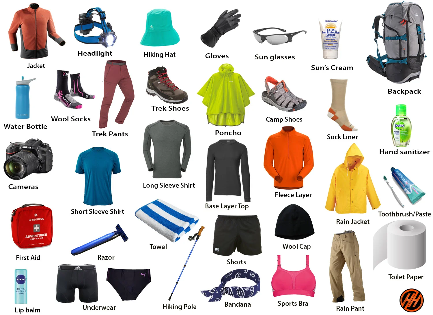
Thermals (top & bottom)
2–3 quick-dry T-shirts (full sleeves preferred)
2 fleece jackets / woollen sweaters
1 down jacket (for winter)
Waterproof & windproof jacket with hood
2 trekking pants (quick-dry)
1 warm/fleece pant (for nights)
Woollen cap / beanie
Sun cap (for daytime)
Neck gaiter / balaclava
Inner gloves (wool/fleece)
Outer waterproof gloves
3–4 pairs trekking socks (wool + synthetic)
1 pair thick wool socks (for night)
Trekking shoes (ankle-high, waterproof, good grip, sturdy sole)
3–4 pairs trekking socks (wool + synthetic blend)
1 pair thick woollen socks (for sleeping at night)
Camp shoes / slippers (lightweight, for evenings at campsite)
50–60 L trekking backpack (with rain cover)
15–20 L daypack (optional for summit day)
Trekking pole
Rain cover for backpack
Headlamp with extra batteries
Water bottles (2 × 1L) or hydration bladder (2L)
UV-protection sunglasses / snow goggles
Sun cap / woollen cap
Buff / neck gaiter / balaclava
Inner fleece gloves + outer waterproof gloves
Power bank
Camera / GoPro (optional)
Toothbrush & small toothpaste
Biodegradable soap / facewash
Hand sanitizer
Wet wipes & tissues
Toilet roll
Lip balm (essential, cold weather dries lips)
Sunscreen (SPF 40+ recommended)
Moisturizer / cold cream
Small towel / microfiber towel
Sanitary napkins / tampons / menstrual cup (for women trekkers)
Deodorant (travel size)
Nail cutter & small comb
Personal prescribed medicines
Diamox (for altitude – doctor’s advice needed)
Crocin / Dolo 650 (fever, mild pain)
Combiflam / Brufen (body ache)
Avomine (motion sickness)
Digene (acidity)
ORS / Electral (dehydration)
Band-aids & crepe bandage
Antiseptic cream / Betadine
Pain relief spray
Government photo ID (Aadhar / Passport / Driving License / Voter ID)
Photocopies of ID (2–3 copies)
Passport-size photographs (2–3, for permits)
Medical certificate (fitness & COVID vaccination if required)
Trek booking confirmation / travel tickets
Emergency contact details
Bali Pass Trek FAQ's
What is the Bali Pass Trek?
The Bali Pass Trek is a challenging high-altitude trek in Uttarakhand, India, connecting Har Ki Dun valley to Yamunotri. It reaches a maximum altitude of 16,207 ft (4,940 m) and offers stunning views of peaks like Swargarohini and Bandarpoonch.
Is the Bali Pass Trek suitable for beginners?
No, this trek is recommended for experienced trekkers. Due to its high altitude, steep climbs, and glacier crossings, good fitness and prior Himalayan trekking experience are important.
What is the best time to do the Bali Pass Trek?
The ideal seasons are May to June and September to October. Avoid the monsoon season (July–August) due to landslides and slippery trails.
How long does the Bali Pass Trek take?
The trek typically takes 8 to 9 days, including travel to and from the base village (Sankri). It covers around 60 km of mountain trails.
Do I need a permit for the Bali Pass Trek?
Yes, permits are required as the trek passes through Govind National Park. If you’re booking with a trekking company, they usually handle permits for you.
What should I pack for the Bali Pass Trek?
Essential gear includes warm layers, trekking boots, rain gear, thermals, gloves, a good backpack, a sleeping bag (if not provided), and high-altitude medication if needed.
What is the altitude gain on the Bali Pass Trek?
The trek starts at around 6,000 ft (Sankri) and ascends to over 16,200 ft at the Bali Pass summit, making acclimatization crucial.
Are there any risks on the Bali Pass Trek?
Yes. Risks include altitude sickness, snowfield crossings, and unpredictable weather. Trekking with a certified guide and acclimatizing properly reduces these risks.
Can I do the Bali Pass Trek solo?
It’s not recommended. The trail is remote, and there are sections with snow, crevasses, and no network coverage. Go with a certified guide or trekking group.
What are the main highlights of the Bali Pass Trek?
The trek offers alpine meadows, the Ruinsara Tal lake, breathtaking Himalayan views, and a dramatic summit crossing from Har Ki Dun to Yamunotri.
Related Treks
- Uttarakhand
- 5 Days
Starts From
₹3,999/-
₹5,500/-
- Transport
- Stay
- Meals
- Guide
Har Ki Doon Trek
- Uttarakhand
- 5 Days
Starts From
₹3,999/-
₹5,500/-
- Transport
- Stay
- Meals
- Guide
Har Ki Doon Trek
- Uttarakhand
- 5 Days
Starts From
₹3,999/-
₹5,500/-
- Transport
- Stay
- Meals
- Guide